| Research Title | .. | : | .. | Seagrass Biomass from Satellite Remote Sensing. |
| Principal Investigator | .. | : | .. | Prof. Sr. Dr. Mazlan Hashim |
| Research Description | .. | : | .. | Seagrass beds are highly productive ecosystem. They maintain complex trophic nets, act as nursery grounds for many marine |
| .. | .. | species, release nutrients to the sea environement, contribute to the oxygenation of the water and act as sediment traps (Odums, 1971). Knowledge of seagrass biomass is very useful for managing and evaluating these ecosystem since it responses quickly to the environmental alterations and its changes are, in many cases, big enough to be monitored using remote sensing (Kirkman, 1996).The objectives of this research are to improve algorithms that can be used for seagrass mapping using high spatial and spectral resolution satellite data. Further, suitable algorithm for seagrass biomass estimation will be determined. In this study, seagrass biomass will be quantified using satellite together with sea-truth measurements at selected study sites i.e. Pulau Sibu, Merambong shoal and Pulau Tinggi.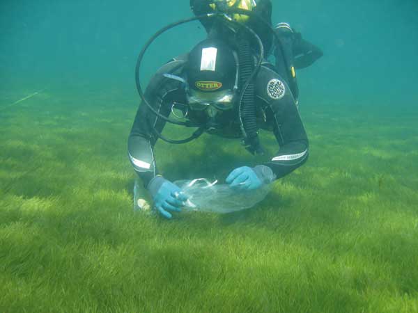 The research will involve predicted and observed methods. Predicted method will involve the development of suitable algorithms that can be used on appropriate satellite data to map seagrass areas. The observed method will involve in-situ sea-truth measurements at the study sites. Some of the in-situ measurements will be used to calibrate the algorithms while other in-situ measurements will be used in the accuracy assessment. Since the satllite data contains geometric distortions, geometric corrections will be carried out. Digital numbers are representing the signal from the seagrass beds will be converted to radiance. Atmospheric correction will be carried out to minimize the effects of the atmosphere on the satellite data. The improvised algorithms will be used to identify seagrass areas with the aid of some sea-truth measurements. For the observed method, estimation of above ground seagrass biomass will be carried out using relevant equipment such as underwater camera with video screen, handheld GPS, quadrat for sampling seagrass, measuring tape, portable weighing equipment and etc. The research will involve predicted and observed methods. Predicted method will involve the development of suitable algorithms that can be used on appropriate satellite data to map seagrass areas. The observed method will involve in-situ sea-truth measurements at the study sites. Some of the in-situ measurements will be used to calibrate the algorithms while other in-situ measurements will be used in the accuracy assessment. Since the satllite data contains geometric distortions, geometric corrections will be carried out. Digital numbers are representing the signal from the seagrass beds will be converted to radiance. Atmospheric correction will be carried out to minimize the effects of the atmosphere on the satellite data. The improvised algorithms will be used to identify seagrass areas with the aid of some sea-truth measurements. For the observed method, estimation of above ground seagrass biomass will be carried out using relevant equipment such as underwater camera with video screen, handheld GPS, quadrat for sampling seagrass, measuring tape, portable weighing equipment and etc. |
+6 07-553 0611
insteg@utm.my