| Research Title | .. | : | .. | Development Retrieval of Variability of Water Yield Using Satellite Multi-Sensor Remote Sensing Data. |
| Principal Investigator | .. | : | .. | Prof. Sr. Dr. Mazlan Hashim |
| Research Description | .. | : | .. | Water will be vital, precious and scarce resources. In hydrologic service, quantity is the first attribute of a water service many |
| .. | .. | people considered. Users may be concerned with the volume of water stored in or discharged from watershed, either above or below ground. The current and future development in water resources is very sensitive to land use and the spreading and intensification ofhuman activities. Estimation of catchments water balance is needed to give an overview of periodic water availability for the purpose of water resources planning and management.Effective integrated water resources management requires timely, accurate and comprehensive meteorological, hydrological and other related information. Determining the spatial and temporal depth of rainfall input to a catchment is necessary for everyday planning and management of the water resources. Hydrological studies that were to determine design of rainfall and potential evapotranspiration are useful parameters in general assessment of water resources availability. Quantification of individual components of the hydrologic cycle, especially at catchment’s scale is a crucial step in integrated watershed management. Usually, regional analyses were carried out to establish a methodology for transposing data to un-gauged sites.  Conventionally the estimation of rainfall has been accomplished by relatively simple instrumentation using rain gauges that sample the rain by capturing a volume over a continuous or fixed time interval. Rain gauges provide a fairly accurate measure of point rates and depths of rainfall. Their major shortcoming however, is that their measurement is only at certain predetermined and limited points and do not provide adequate aerial coverage. The result of this is that rainfall measured is relatively accurately for small areas with a network of rain gauges, but this approach is not practical for large and remote areas of the earth.The quantification of hydrological budget is extremely difficult over large spatial and temporal domains through direct observations, therefore remote sensing technology has been extensively used to estimate various critical factors like landuse–landcover, runoff, evaporation, evapotranspiration. Satellites obtain information about the distribution and amounts of precipitation both directly and indirectly. Direct observation is by passive sensing of the microwave energy absorbed and scattered by hydrometeors and conversion of these observations into estimates of rainfall rates by accounting for the background radiation from the earth’s surface and making assumptions about the size distribution of the hydrometeors. Indirect observation is by sensing infrared radiation emitted by clouds, converting the radiation flux into cloud-top temperature, making use of empirical correlations of the spatial and temporal coverage of clouds with temperatures below a threshold value and rainfall. Conventionally the estimation of rainfall has been accomplished by relatively simple instrumentation using rain gauges that sample the rain by capturing a volume over a continuous or fixed time interval. Rain gauges provide a fairly accurate measure of point rates and depths of rainfall. Their major shortcoming however, is that their measurement is only at certain predetermined and limited points and do not provide adequate aerial coverage. The result of this is that rainfall measured is relatively accurately for small areas with a network of rain gauges, but this approach is not practical for large and remote areas of the earth.The quantification of hydrological budget is extremely difficult over large spatial and temporal domains through direct observations, therefore remote sensing technology has been extensively used to estimate various critical factors like landuse–landcover, runoff, evaporation, evapotranspiration. Satellites obtain information about the distribution and amounts of precipitation both directly and indirectly. Direct observation is by passive sensing of the microwave energy absorbed and scattered by hydrometeors and conversion of these observations into estimates of rainfall rates by accounting for the background radiation from the earth’s surface and making assumptions about the size distribution of the hydrometeors. Indirect observation is by sensing infrared radiation emitted by clouds, converting the radiation flux into cloud-top temperature, making use of empirical correlations of the spatial and temporal coverage of clouds with temperatures below a threshold value and rainfall.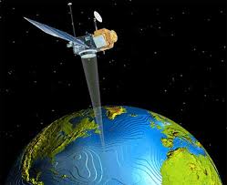 With the advent of meteorological satellites in the 1970s, great efforts have been directed to estimating precipitation from satellite data, which cover most of globe. The Tropical Rainfall Measuring Mission (TRMM), a joint project by National Aeronautics and Space Administration (NASA) of the US and the Japan Aerospace Exploration Agency (JAXA) launched in 1997, provides a wealth of information on global tropical rainfall. As the first satellite with precipitation radar dedicated to rainfall measurement, TRMM indirectly estimates precipitation with the deployment of several passive microwave sensors. The basic principle of TRMM precipitation estimates is based on the relationship between microwave radiation and the amount of water in the cloud through Planck’s law. There are several TRMM rainfall products available by combining measurements from different sensors in the estimation algorithm. TRMM long latency (available 10–15 day after the end of each calendar month) research quality product (3B42v6), have found significant relationship (i.e. R20.63 to 0.96) with rainfall data obtained from Malaysia Meteorology Department.Generally, precipitation is the main input for water balance models and as such, its accuracy of the measurement from a network of stations determines to a considerable extent the reliability of water balance computations. Rainfall being amongst the hydrological parameters is the most difficult to measure due to its greatest temporal and spatial variability and discontinuity. This proposal is to investigate potential water resources estimated using rainfall intensity obtained from satellite data. Firstly, we assessed monthly rainfall intensity obtained from satellite data and then, annual potential water resources availability distribution map produced. The full-based satellite based system reporting the yield for all Malaysian watersheds in weekly, monthly and yearly. Prediction of the water yields with of incorporation of cloud trajectory probability based on stationary Geosynchronous Meteorological Satellite (GMS) is also anticipated. The prototype of fully-satellite based DSS is final output of this project, very vital in assisting the management and planning of water resources for all watersheds in Peninsular Malaysia. This DSS may fully benefits to National Water Resource Department in quantifying water sources for whole Peninsular Malaysia.The framework of policy development for utilization of geospatial technology applications is also undertaken in the research. The framework first initiate the awareness of the related geospatial technologies, before focusing to application to water resource management, particularly for one way in which we can improve our water security efficiency, is through a comprehensive GeoSpatial based analysis. A comprehensive GeoSpatial analysis system that integrates all geospatial data can assist better understand the mechanics of water security. It is proposed that a bill be enacted that will centralize all water related GIS and spatial data, and make GeoSpatial technology central to all planning, services and infrastructure development related to water in Malaysia. The bill calls for the creation of central GeoSpatial water portal database to be created where the system can be shared with departments and local bodies, both from the public and private sector. The spatial information is crucial not only for national security, but also for the socio-economic development of the nation |
+6 07-553 0611
insteg@utm.my