by idiana | May 21, 2012 | Uncategorized
Facilities
INSTeG laboratories are equipped with good facilities including specialized hardware for field data acquisition, software processing and analysis in various geometics disciplines. These equipments are located in:
INSTeG remote sensing research lab
INSTeg hydrographic surveying lab
INSTeG geographical information system (GIS) lab
INSTeG cadastre and land information research lab
Precise Surveying and Geodetic metrology (PGSM)

by idiana | May 21, 2012 | Uncategorized
Research Area
With pool of highly trained personals, we emphasize our research and development; training and consultancy services in the following area:
Precise Surveying and Geodetic metrology (PSGM)
Engineering structural deformation study; dimensional control; automation surveying; natural hazards mitigation and sustainable; underground mapping; reflectorless mapping; optimization of accuracy and logistic in engineering metrology; Intelligent deformation monitoring system; precise industrial surveying and advanced survey adjustment.
Remote sensing (RS)
Applications for natural resource and environmental management including vegetation studies and carbon mapping, remote sensing for land and environmental applications, satellite oceanography, microwave remote sensing and advance mapping, sensor development and Image processing technologies.
Land Information Management and Cadastre (LIMC)
Cadastral survey; accurate cadastral database; multipurpose cadastre and marine cadastre.
Spatial Data Infrastructure (SDI)
Regional spatial data infrastructure; marine SDI and geospatial accuracy assessment.
by idiana | May 21, 2012 | Uncategorized
Overview
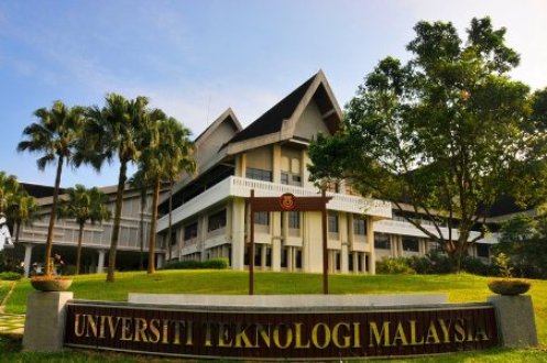
Institute of Geospatial Science & Technology (INSTeG) is Universiti Teknologi Malaysia’s Centre of Excellence in Geomatic (Geo-Technology). It was first established in March 2003 to provide support for diverse spectrum of surveying and mapping research and development activities at the Faculty of Engineering and Geoinformation Science (FKSG), Universiti Teknologi Malaysia. The institute also seeks win-win collaborations between all institutions of higher learning, related research institutions as well as the industries in realization of research, knowledge advancement, professional practice, and technology-transfer in the field of Geospatial Sciences and related technology.
INSTeG was strategically re-aligned in September 2009, to further strengthen and materialize research and development activities as centre of excellence (COE) with consultancy services thrust under the Ministry of Higher Education, Malaysia (MOHE).
Research Area
With pool of highly trained personals, we emphasize our research and development; training and consultancy services in the following area:
Precise Surveying and Geodetic metrology (PSGM)
Engineering structural deformation study; dimensional control; automation surveying; natural hazards mitigation and sustainable; underground mapping; reflectorless mapping; optimization of accuracy and logistic in engineering metrology; Intelligent deformation monitoring system; precise industrial surveying and advanced survey adjustment.
Remote sensing (RS)
Applications for natural resource and environmental management including vegetation studies and carbon mapping, remote sensing for land and environmental applications, satellite oceanography, microwave remote sensing and advance mapping, sensor development and Image processing technologies.
Land Information Management and Cadastre (LIMC)
Cadastral survey; accurate cadastral database; multipurpose cadastre and marine cadastre.
Spatial Data Infrastructure (SDI)
Regional spatial data infrastructure; marine SDI and geospatial accuracy assessment.
Facilities
INSTeG laboratories are equipped with good facilities including specialized hardware for field data acquisition, software processing and analysis in various geometics disciplines. These equipments are located in:
INSTeG remote sensing research lab
INSTeg hydrographic surveying lab
INSTeG geographical information system (GIS) lab
INSTeG cadastre and land information research lab
Precise Surveying and Geodetic metrology (PGSM)


